MustLoveJapan

Trekking the Mt.Bandai

交通信息

Trekking at Mt.Bandai (磐梯山登山) is very popular hiking in Fukushima Prefecture. Mt. Bandai is 1,816m tall active volcano, and has a great view of Lake Inawashiro, Aizu Basin and Urabandai from the top. The trekking takes about 4 hours in total. Time is very shourt, but the route is very steep. There is Onsen and drinkable water spring on the route.

Tourist Info.
There are parking and restroom at Happodai entrance.
There is a shop at Koboshimizu, that is located in the middle of trekking route.
Video is using Happodai trekking route, but there are 5 other route to reach the top.

Access
Need a car. Drive north at route 64.


Samurai Movie The Ronins New Wave Samurai Movie.

MLJ在线商店

the Ronins 映画好き集まれ!

周围的地图 Trekking the Mt.Bandai

旅游详情介绍

Trekking the Mt.Bandai

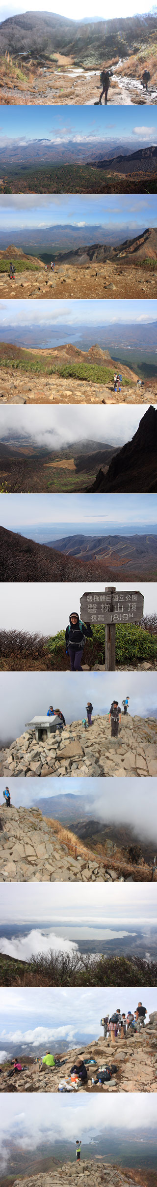
The altitude: 1,816m from the sea level.
The altitude difference: 620m
Rank: shourt, but very hard.

Mt. Bandai is one of 100 best Japanese mountains. Because of the quick route of trekking, it is very popular mountain in Fukushima.

The route of the video
Happodai entrance
Nakanoyu (Onsen Spring)
Ohanabatake Observatory
Koboshimizu (Resting place, shops and water spring)
The Top.